This blog is being posted about 7 months late as the photos start on July 5, 2012. One day I will get caught up (when I stop having so much fun)! Also, I deleted the original post which explained the photos, but I did not recreate those labels, I just threw the photos up again!
Well since Bolivia isn’t on the direct path of traveling from Argentina to Alaska I had to detour a bit to go there. After all, the detour only meant that I had to cross the Andes for the fourth time ! And shoot, why not, the Andes there are much higher than in southern Chile and Argentina!
My reasons for going into Bolivia were:
1) to ride across the Salar de Uyuni
2) to return for a visit to Ginger’s Paradise (the organic farm where I spent sometime in 2010 recovering from my surgery from my infected ocelot bite)
3) to meet a friend from the states in Santa Cruz
4) to visit the very unvisited, untouristy national park Noel Kempff Mercado in the northeast corner by Brazil.
I entered Bolivia from Ollague, Chile to Avaroa in the southwest corner of Bolivia after about a steady 9 day climb from sea level in Antofagasta, Chile to 13,134 feet (3980 meters). From the border I changed it up a bit and took a train across what I wasn’t sure was a “ride-able” road or not and a route that I couldn’t get any current information from anyone about. The $5 train fare and 5 hour ride was a sure way to get to Uyuni so I took it. The train was comfortable enough because I had my sleeping bag and my headlamp in the unheated and unlighted train and it was a beautiful but very cold full moon night.
I remained at the higher altitudes of Uyuni putzing around for about a week before climbing higher to a max elevation near Potosi, Bolivia of 13,883 feet (4207 meters). I felt really good at altitude actually and never really felt like I was sucking wind (not any more than usual that is J).
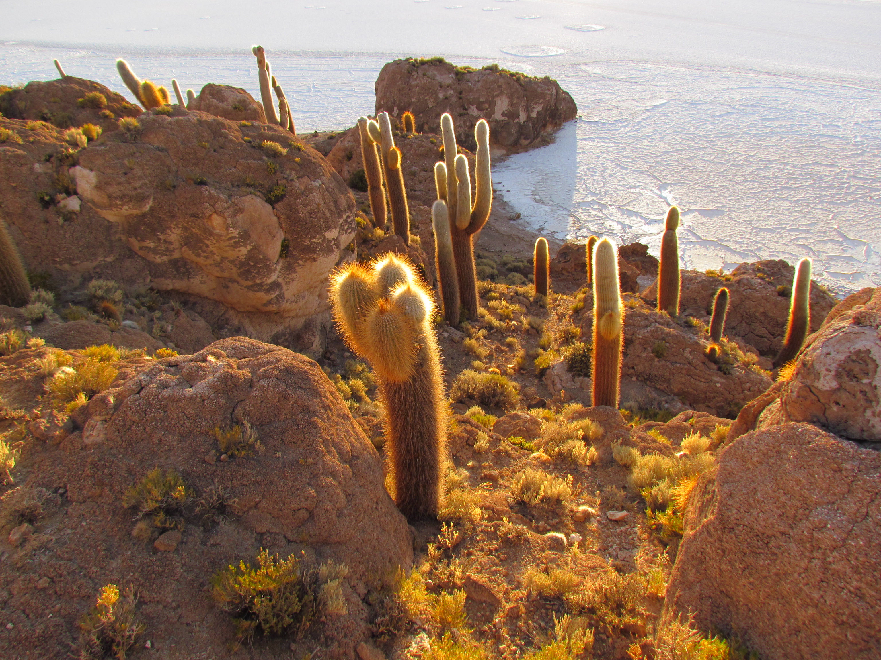
From Wikipedia: The Salar de Uyuni (or Salar de Tunupa) is the world's largest salt flat (hence Please Pass the Salt) at 4,086 sq mi (10,582 square kilometers) which is roughly 25 times the size of the Bonneville Salt Flats in the United States. It is located near the crest of the Andes, and is at an elevation of 11,995 ft (3,656 meters) above mean sea level.
The Salar was formed as a result of transformations between several prehistoric lakes. It is covered by a few meters of salt crust, which has an extraordinary flatness with the average altitude variations within one meter over the entire area of the Salar. The crust serves as a source of salt and covers a pool of brine, which is exceptionally rich in lithium. It contains 50% to 70% of the world's lithium reserves, which are in the process of being extracted. The large area, clear skies and the exceptional flatness of the surface make the Salar an ideal object for calibrating the altimeters of Earth observation satellites.
It was very cold in this area at night. The temp inside my tent on the salar was 18˚F (-8˚C). I didn’t spend any time outside my tent once the sun went down and I used my “Go Girl” often!
In Bolivia in general I spent a lot more nights in guest houses because they are so cheap and I ate out a lot and barely cooked on my stove at all. I kind of miss my tent at times but it has been truly hard to find places that are safe or practical to camp. Bolivians were very friendly and everywhere I stopped people were very interested in what I was doing. It sometimes gets old telling the same story over and over but I keep myself in check and smile while I answer as if it is the first time I am answering the questions.
I rode a lot at high altitude and fortunately had no problems in all of the mountains I trudged up. At the end of my stay I visited the jungle as well which will probably be covered in the next blog post.


Here is a link to the map of my route in Bolivia. Parts of the route marked in black are where I took the train and bus. https://maps.google.com.ec/
More Bolivia photos and commentary will follow in upcoming blog posts:
Welcome to the Jungle-my account of my very challenging visit to Noel Kempff Mercado National Park.
Photos and blog posts to come from Peru:
I Get By With A Little Help From My Friends
Everything You Ever Wanted To Know About Being Robbed In Peru
And I am in Ecuador now BTW!!! Haven’t even thought of a blog post yet for here.